
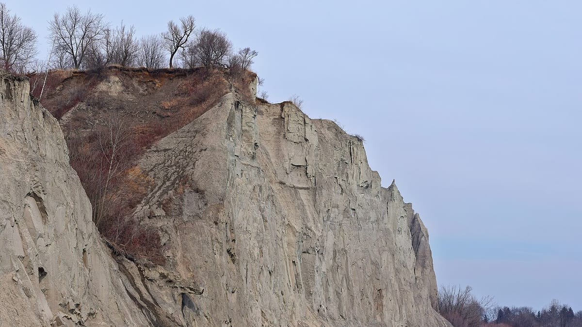
Visit Scarborough Bluffs for a lakeside walk and views of the cliffs, not as a single attraction with one entrance. Choose Bluffer's Park for a beach-level outing or a designated upper park for elevated views. The crucial rule is simple: stay behind barriers and never use the cliff face as a shortcut between the two.[1]
First choose the version of the Bluffs you want
The City of Toronto describes eleven parks along approximately 15 kilometres of the Scarborough Bluffs. They offer different combinations of gardens, shoreline access, recreation space and viewpoints; they are not interchangeable entrances to one continuous visitor site.[1]
That explains a common planning disappointment. Someone searches for a dramatic photograph, follows the nearest map pin and arrives at a park above the lake when they expected a beach. Another visitor reaches the beach and assumes a direct footpath must lead to every viewpoint overhead. Neither assumption is a reliable way to plan the outing.
For a first visit focused on the water, use Bluffer's Park and Beach as your destination. For an elevated landscape view, identify an upper park and its permitted viewing area before leaving. Choose one primary experience rather than building a day around an unverified route between them.
The city lists several upper parks without a trail to the lakefront. Its directory separately identifies permitted shoreline access at other locations, such as the Doris McCarthy Trail from Sylvan Park.[1] A visible gap in vegetation is not the same thing as an official path.
What a beach-level visit is actually like
At Bluffer's Park, the attraction is the combination of water, open space and views back toward the bluffs. The park and beach sit at the foot of Brimley Road South.[2] Think of the visit as a flexible outdoor block rather than an attraction to be completed at a specific pace.
A sensible first outing is to arrive, orient yourself at the park signs, walk the public waterfront areas and choose somewhere to sit before deciding whether to extend the visit. For photography, allow time to explore safe, permitted viewpoints instead of assuming the first place beside the parking area will produce the composition you had in mind.
A picnic can make the outing feel less like a long journey for a short photograph. Bring what you need for the planned duration, and keep the return journey in mind when deciding how much to carry. A heavy cooler that is easy to unload from a car is a different proposition from a bag carried down and back up an approach road.
Allow at least a relaxed couple of hours on site as an editorial planning suggestion, not an official minimum. Add more time for a picnic or a slow walk. On a short Toronto trip, it is usually better to enjoy one waterfront area properly than to spend the afternoon moving between several widely separated Bluffs parks.
Summer for a beach day; cooler months for a shorter walk
Summer is the logical season when swimming is central to the plan, but a beach designation alone does not establish that conditions are suitable that day. Use the city's current beach information for lifeguard coverage and water-quality notices. As of 28 October 2026, Toronto states that the 2026 lifeguard season has ended and will resume in 2027.[3]
That makes a November visit a walking and landscape outing, not a recommendation for a supervised swim. Wear layers that work while standing still near the water as well as while walking. A forecast that feels comfortable between downtown buildings may not feel equally comfortable during a long exposed stop by the lake.
Autumn can be a good choice when you want scenery without designing the day around swimming. The trade-off is a shorter daylight window and a greater need to keep the plan flexible. For a late-afternoon visit, arrange the return before you settle in for photographs rather than waiting until the light has gone.
Winter requires a different threshold. A brief visit in suitable conditions may be enjoyable, but a steep, slippery approach or an exposed path is a good reason to choose another activity. Do not use a social-media image of a dramatic winter shoreline as evidence that the route is safe or maintained for your intended walk.
In any season, choose the conditions that suit your activity. A clear, calm day is more useful for a leisurely picnic than a date selected solely because it is the only empty square in the itinerary. The Bluffs are an optional outdoor experience, not a reservation you must honour regardless of weather.
The safety distinction that photographs leave out
The city explicitly warns that the bluff edge is unstable and instructs visitors to stay behind fences.[1] The warning applies even when other people have crossed a barrier or when the ground appears dry and solid.
A cliff-edge photograph is not worth treating the boundary as negotiable. Frame the landscape from permitted areas and accept that some images online may have been taken from places you should not enter. Do not follow footprints as proof of an approved route.
The same principle applies below. Remain on permitted paths and public areas rather than walking close to an unstable face to make it look larger in a photograph. Keep children within an area you have already assessed, not simply within sight somewhere beyond a barrier.
For a group with mixed mobility, choose the outing according to the least manageable part of the route. The important question is not merely whether someone can walk along the waterfront; it is whether they can comfortably reach it and return. A planned vehicle pickup at the correct lower location can matter more than the nominal distance of the stroll itself.
Make transport support the visit
Do not enter only "Scarborough Bluffs" into a journey planner. Use the exact park and entrance you have selected. A route to an upper street may leave you far from the beach experience you intended.
The TTC identifies a seasonal Bluffer's Park service, while its general visitor guidance also describes reaching Kingston Road and Brimley Road before walking south.[4][5] These are different practical experiences. An itinerary that includes a substantial approach walk should not be presented as though the bus drops everyone beside the sand throughout the year.
For a car visit, use legal parking and follow the current signs rather than assuming nearby residential streets are overflow parking. For a taxi or rideshare, save the pickup point while you have a clear sense of the park layout. For public transport, establish the return route and its operating date before starting the descent.
The most satisfying first visit is usually modest: one correctly chosen park, enough daylight to enjoy it, a realistic way home and no attempt to turn a cliff into a staircase. That leaves the landscape, rather than a navigation mistake, as the memorable part of the afternoon.